
Good projects depend on accurate land data, and there are two ways to get it. Traditional surveying has measured and mapped land for decades. Digital mapping is the faster, data-rich successor. Neither is simply better than the other, but for most modern projects in Saudi Arabia and Qatar, one is usually the right call. Here is how they compare and when to use each.
In this article
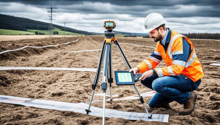
How traditional surveying works
Traditional surveying gathers data on boundaries, positions, and features manually, using instruments such as theodolites, tapes, and total stations. It needs qualified surveyors physically on site to measure levels, angles, and distances. It produces reliable results, but on large or complex projects it can be slow, labour-intensive, and more exposed to human error.
What digital mapping is
Digital mapping is the newer approach, using drones, GPS, LiDAR, and GIS to produce highly accurate, dynamic maps. Instead of static hand-drawn outputs, it creates geo-referenced 2D and 3D data that is easy to share, store, and analyse. That makes it well suited to large construction, infrastructure design, and built projects across the GCC.
The key differences
| Factor | Traditional surveying | Digital mapping |
|---|---|---|
| Accuracy | Reliable, with some room for manual error | Millions of precise data points |
| Speed | Days or weeks on large sites | Hours over large areas |
| Data | Static 2D maps and reports | Interactive 3D models and GIS data |
| Cost | Lower setup, higher time cost | Higher setup, lower cost over time |
| Best for | Small plots, legal boundaries | Large, complex, high-precision work |
It is not old versus new. It is matching the method to the size and complexity of the job.
When digital mapping wins
In fast-growing markets like Saudi Arabia and Qatar, where smart-city and large-scale projects are common, digital mapping is usually the better fit. Contractors rely on accurate, timely data to avoid costly errors when planning metro systems, road corridors, or new districts, and digital mapping connects directly into BIM and design workflows. For anything large, complex, or precision-critical, it is the stronger choice.
When traditional still makes sense
Traditional surveying has not gone away, and for good reason. For small plots, individual holdings, or formal boundary documentation, it can be perfectly adequate and cost-effective. The honest answer is that the right method depends on the job: digital mapping for large, fast, high-precision work, and traditional methods where the task is small or legal in nature. Compass Arabia offers both through its surveying services, and will recommend the one that genuinely fits your project rather than defaulting to the most expensive tool.