
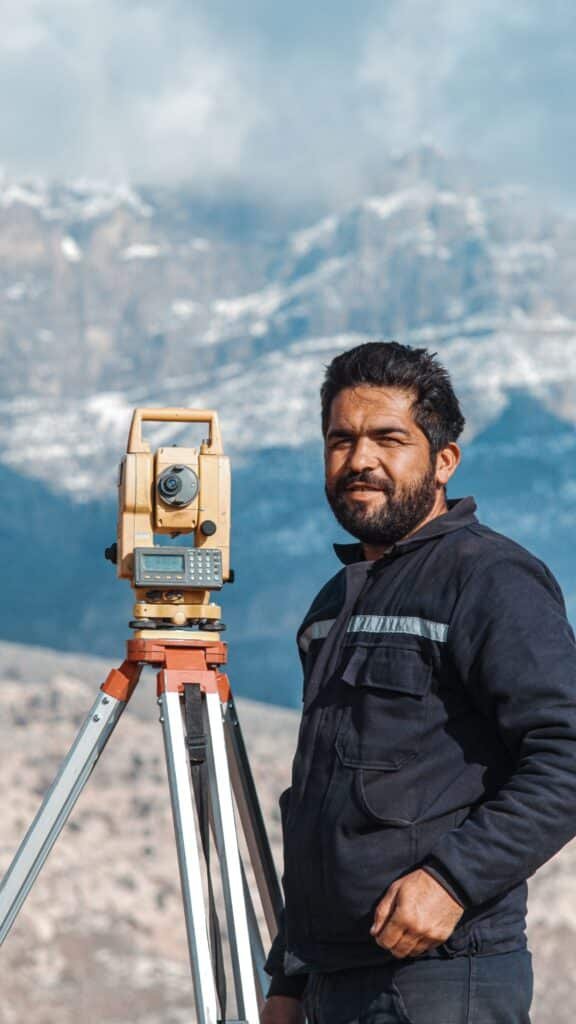
Every building, road, and pipeline in Qatar, the UAE, and Saudi Arabia starts with a survey crew on site long before anyone pours concrete. Construction surveying sets the boundaries, elevations, and reference points a project is built against, and a mistake made in week one has a habit of showing up months later as a wall that will not line up or a slab poured at the wrong level.
In this article
What construction surveying actually covers
People use land surveying and construction surveying as if they mean the same thing, and on a small residential plot they can overlap. On anything bigger, they are two different jobs. Land surveying establishes where a property’s legal boundaries sit. Construction surveying takes over once design is underway and keeps the physical build aligned with the drawings, from the first stake in the ground to the last inspection before handover.
A topographic survey usually comes first. It records the ground as it actually is, not as the site plan assumes it to be: elevations, slopes, existing structures, drainage lines, trees, utility markers, anything that could change a foundation design or a drainage route. Engineers design against that data, not against a flat assumption, which is why a rushed or incomplete topographic survey tends to surface later as an expensive redesign.
Where it sits in the project timeline
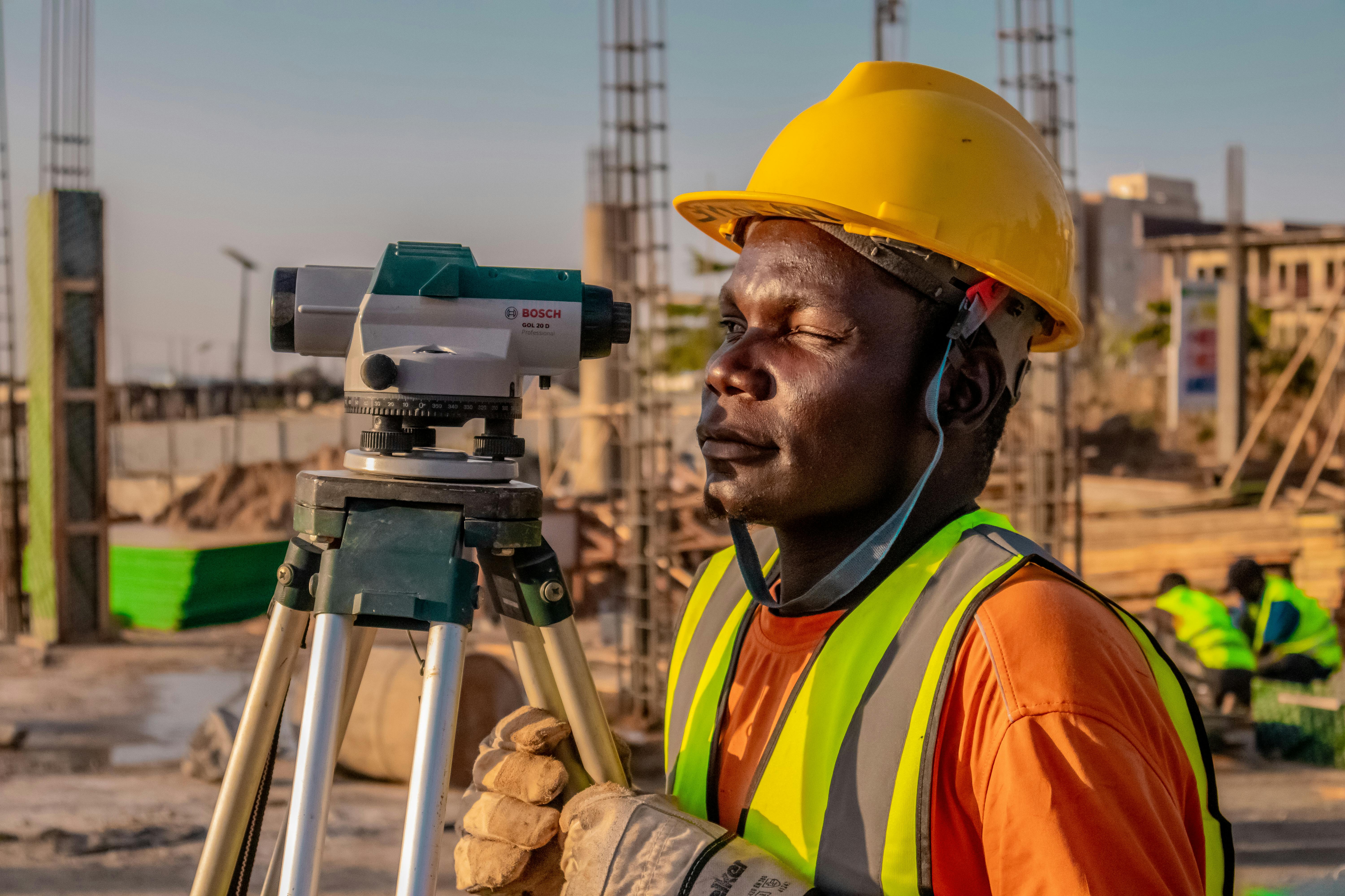
Surveying is not a single visit. It runs through the whole build in stages, and each stage answers a different question. Before design, a topographic and boundary survey tells the design team what they are actually working with. Once excavation starts, a setting-out survey places the exact position of columns, footings, and grid lines on the ground, translating a drawing into physical marks a contractor can build against.
As the structure rises, surveyors keep checking verticality and level, because concrete does not correct itself once it has cured. At handover, an as-built survey records what was actually constructed, which can and does differ from the design by small but real margins. That final record matters more than most clients realize until they need it, whether for a fit-out years later or a dispute over where a boundary wall actually sits.
The equipment doing the work now
Surveying technology has moved a long way past a tripod and a tape measure, though the tripod is still there. A total station, which measures angles and distances optically, remains the workhorse for setting out and precise control points on most Gulf sites. GNSS rovers, using satellite positioning rather than a fixed instrument, cover large open areas fast and are common on infrastructure and roadworks where a site can stretch for kilometers.
Where a site needs millimeter-level detail of an existing structure, terrestrial 3D laser scanning captures millions of points in minutes, which is far faster and more complete than measuring a facade by hand. Underground conditions get their own equipment entirely: ground-penetrating radar and utility locators map what is buried before excavation starts, which matters on any site with existing services nearby. Our underground utilities team runs that scan as a standard pre-excavation step on urban sites, because striking a live cable or pipe is not a risk worth taking on a guess.
Drone surveying and where it actually helps
Drone surveying earns its place on large or awkward sites rather than every site. A drone fitted with a mapping camera can cover a quarry, a stockpile, or a highway corridor in a single flight and produce an orthomosaic and elevation model that would take a ground crew days to walk. Volume calculations for earthworks and stockpiles are one of the strongest use cases, since a drone gets a full-site figure instead of a sampled estimate.
It is not a replacement for ground survey everywhere. Dense urban plots with overhangs, tight setbacks, or restricted airspace near airports still call for a ground crew, and boundary-critical work needs the accuracy of a controlled ground survey rather than an aerial pass. The right answer on most projects is a mix: drone survey for the broad picture and change tracking over time, ground instruments for anything that has to hold up to a millimeter. Our drone survey service is usually paired with ground control points for exactly this reason.
Mistakes that cost time on site
The most common and avoidable mistake is skipping a proper utility check before breaking ground, usually to save a few days on the program. It rarely saves anything once a contractor hits an unmapped line and work stops while everyone works out what got hit and who is liable. A close second is relying on an old reference point or benchmark without verifying it still holds, which happens more often than clients expect on sites that have changed hands or been partially built out before.
Poor communication between the survey team and the site team causes its own problems: a setting-out mark gets disturbed by other trades, nobody notices, and a column goes in slightly off grid. None of this needs exotic equipment to avoid. It needs a survey plan that matches the actual risk on that site, done by a team that flags problems early rather than one that just delivers a file and moves on.
Choosing a surveying team in the Gulf
Site conditions differ enough across the region that local experience is worth more than a generic credential. A team working in Qatar deals with reclaimed land and a dense underground utility network in Doha’s older districts. Work in Dubai often means coordinating around active high-rise neighbors and tight urban plots. Projects in Saudi Arabia increasingly run at giga-project scale, where a survey program has to hold accuracy across a footprint measured in kilometers rather than meters.
What to actually check before appointing anyone: the calibration record of their instruments, whether they carry both ground and drone capability so you are not managing two separate contracts, and whether they will hand over raw data and coordinates, not just a finished PDF. A surveyor who explains what they found and why it matters for your build is worth more than one who simply delivers a report and disappears. Our surveying services team covers both ground and aerial methods across all three markets, which keeps one point of contact through a project rather than several.