- Doha, Qatar | Riyadh, Saudi Arabia | Dubai, UAE

Professional Drone-Based Mapping Services by Compass Arabia
The way survey teams collect site data has changed dramatically over the last decade. At Compass Arabia, we have embraced drone technology not as a gimmick, but as a genuinely faster, safer, and more cost-effective way to capture the high-resolution spatial data that modern construction and infrastructure projects demand.
Our drone-based mapping services cover Qatar, Saudi Arabia, and the UAE. We deploy professional-grade UAVs equipped with high-resolution cameras, LiDAR sensors, and precision GNSS positioning systems to deliver aerial mapping data that meets engineering-grade accuracy requirements. Whether you need a site survey completed in hours rather than days, or you need to monitor construction progress across a large area, our drone mapping team delivers results you can act on.
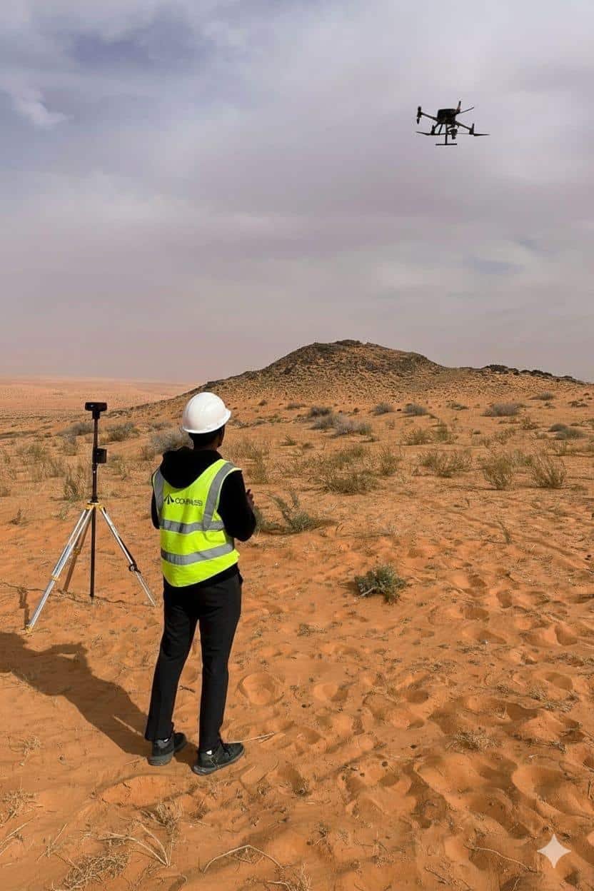
What Is Drone-Based Mapping?
Drone-based mapping, also known as UAV mapping or aerial photogrammetry, is the process of using unmanned aerial vehicles to capture overlapping aerial images or LiDAR point cloud data across a site. This data is then processed using specialised photogrammetry software to generate accurate, georeferenced survey products.
Compared to traditional ground-based surveying methods, drone mapping offers significant advantages:
- Surveys large areas much faster, covering in hours what traditional survey teams take days to complete
- Safer for difficult terrain, active construction sites, and environmentally sensitive areas
- Produces rich, visual data including orthomosaic maps, 3D point clouds, and digital elevation models
- Lower mobilisation costs for large site surveys
- Easily repeated for progress monitoring and change detection over time
For GCC construction, infrastructure, and land development projects, drone mapping is now an essential tool in the professional surveyor’s toolkit.
Our Drone Mapping Services
Orthomosaic Mapping and Aerial Photogrammetry
We take dense overlapping aerial photos and turn them into high-resolution orthomosaic maps, which are aerial photos that have been mathematically rectified to act like precise maps. For site planning, progress monitoring, client reporting, and regulatory submissions, orthomosaics are perfect. Depending on the needs of the project, our orthomosaic solutions can be produced at a ground resolution of less than 5 cm.
Terrain Analysis and Digital Elevation Models (DEM)
We create Digital Surface Models (DSMs) and Digital Terrain Models (DTMs) that precisely depict ground elevations throughout your site using drone photogrammetry and LiDAR. For building projects in the Gulf Cooperation Council, these models assist with earthworks design, drainage planning, flood risk assessment, and cut-and-fill volume calculations.
Drone LiDAR Surveys
We use LiDAR-equipped drones for projects that need the highest levels of precision or that involve complicated terrain, existing structures, or dense vegetation. LiDAR technology creates dense 3D point clouds that precisely record both above-ground features and bare-earth topography by using laser pulses to calculate distance.
Monitoring Construction Progress
Frequent drone surveys give stakeholders and project managers precise, current data of construction progress across big sites. To create progress reports, monitor earthworks volumes, confirm contractor milestones, and spot possible problems before they become expensive ones, we can plan weekly or monthly drone surveys.
Extensive Site Surveys
Drone mapping provides a useful substitute for traditional survey techniques for road alignments, infrastructural corridors, master-planned developments, and major industrial sites. We provide comprehensive site survey files that integrate straight into CAD and GIS platforms, effectively covering enormous areas.
Mapping Land Development and the Environment
Drone surveys are useful for environmental monitoring, vegetation mapping, land cover classification, and erosion assessment since they are consistent and repeatable. The drone mapping team at Compass Arabia provides the geographical data required for impact assessments, planning applications, and environmental compliance reporting to land developers and environmental consultants.
Surveys of Infrastructure Inspections
Drones are used to take high-resolution pictures of infrastructure that is difficult to access, such as electricity lines, pipelines, bridges, elevated structures, and coastal embankments. By eliminating the need for workers to enter hazardous areas, drone inspection surveys increase safety while providing comprehensive visual data for condition evaluation and maintenance scheduling.
Why Choose Compass Arabia for Drone Mapping?
Extensive GCC Project Experience
Compass Arabia’s drone mapping team brings together technical expertise, regional experience, and genuine field professionalism:
GCC-experienced team
We understand the regulatory environment for UAV operations in Qatar, Saudi Arabia, and the UAE and hold appropriate operating permissions.
Engineering-grade accuracy
Our drone surveys are controlled using ground control points (GCPs) and GNSS positioning to meet the accuracy requirements of engineering and construction projects.
Advanced equipment
We operate professional-grade multirotor and fixed-wing UAV platforms equipped with survey cameras and LiDAR sensors.
Full data processing
We don’t just fly, we process, quality-check, and deliver finished survey products ready for engineering use.
Fast delivery
Most drone survey datasets are processed and delivered within 24–72 hours of data capture.
Integration with wider survey services
Drone mapping works alongside our ground-based GPS, hydrographic, and 3D laser scanning services for complete site coverage.
Our UAV Survey Experience Across the GCC
Compass Arabia has completed drone mapping projects across Qatar, Saudi Arabia, and the UAE for some of the region’s most demanding infrastructure and construction programmes.
Our team has conducted UAV surveys for large-scale land development projects, infrastructure corridor mapping, construction site monitoring, and environmental assessment programmes.
We have operated in challenging environments, desert terrain, coastal zones, active construction sites, and urban areas, and we bring that practical, real-world experience to every drone survey we undertake. When you work with Compass Arabia, you get a team that has already solved the problems your project is likely to face.
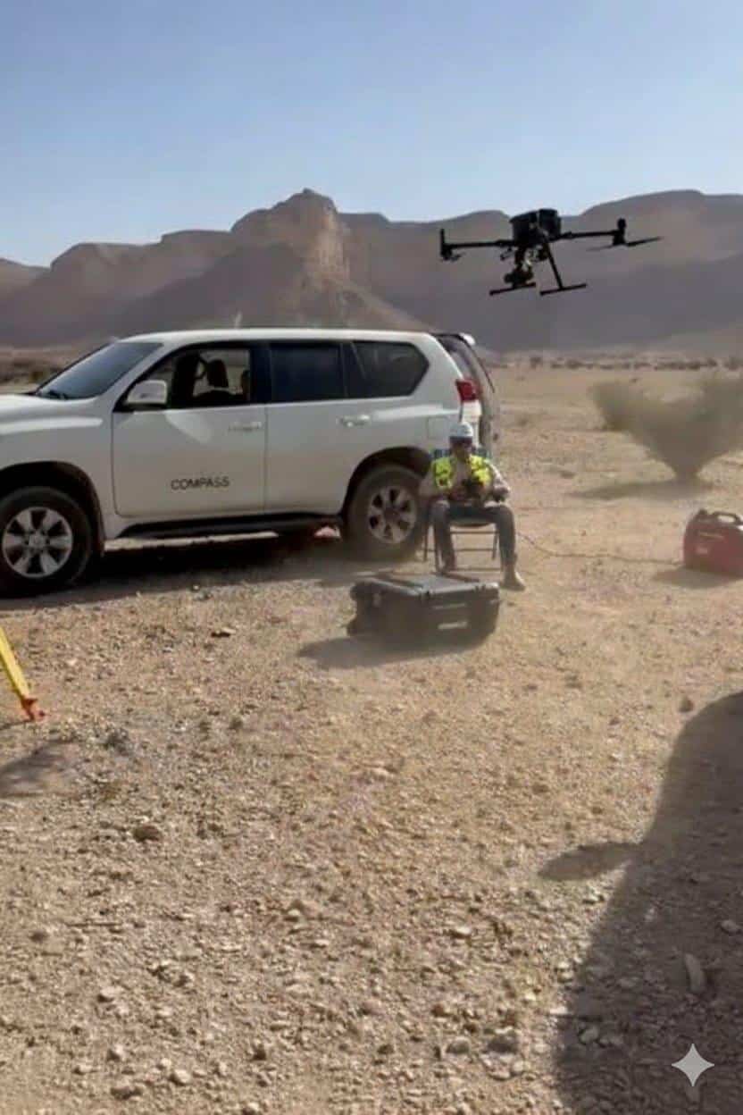
Trusted Drone Mapping Across the GCC
Compass Arabia provides Drone Mapping services across the GCC for
Construction Companies
Oil & Gas Operators
Infrastructure Developers
Industrial Facilities
Engineering Consultants
Marine & Offshore Sectors
Utility Providers
Government Authorities
Real Estate Developers
FAQ's
What accuracy can drone mapping achieve?
With proper ground control points and GNSS positioning, our drone mapping surveys typically achieve horizontal accuracies of 2–5cm and vertical accuracies of 3–8cm, sufficient for most engineering and construction applications.
How large an area can you survey by drone?
A single drone can efficiently survey 50–200 hectares per day depending on the platform, flight height, and required resolution. For very large sites, we deploy multiple platforms to complete surveys within tight programme windows.
Do you handle UAV operating permits?
Yes. Compass Arabia manages all UAV operating permit applications and regulatory compliance for drone operations in Qatar, Saudi Arabia, and the UAE. We ensure all flights are conducted legally and safely.
What formats do you deliver drone survey data in?
We deliver orthomosaic maps, point clouds, DEMs, and contour data in formats including GeoTIFF, LAS/LAZ, DXF, DWG, and Shapefile, compatible with AutoCAD, Civil 3D, ArcGIS, and other engineering platforms.
Can drone surveys replace traditional land surveys?
Drone surveys complement and often partially replace traditional ground-based surveys for large area coverage. However, detailed site setting out, utility detection, and legal boundary work typically still require ground survey teams. We combine both methods to give you the most efficient and accurate solution for your project.
Contact Compass Arabia
Looking for reliable drone mapping services in the GCC?
Compass Arabia delivers accurate, technology-driven drone surveying and aerial mapping solutions for construction, infrastructure, industrial, environmental, and land development projects across Qatar, Saudi Arabia, and the UAE.
Contact our team today to discuss your project requirements and receive expert UAV mapping, aerial survey, and drone data capture services tailored to your operational and engineering needs.