Traditional approaches might no longer be sufficient if you’re organizing a land survey in Saudi Arabia. Businesses all around the Kingdom are implementing quicker, safer, and more precise surveying methods as a result of the development of drone technology. Drones are revolutionizing the collection and analysis of land data, from NEOM to mega-industrial zones.
What exactly is land surveying with drones?
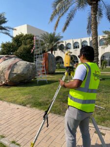
UAVs (Unmanned Aerial Vehicles) are used in a drone-based land survey in Saudi Arabia to collect geospatial data and high-resolution aerial imagery. Compared to teams working on the ground, this data is processed far more quickly to produce maps, 3D landscape models, and thorough reports.
The Benefits of Drone Surveys for Saudi Arabia’s Terrain
Drone surveys are a wise decision because of Saudi Arabia’s tough and diverse terrain:
Rapidly covering vast swathes of desert
mapping rough or isolated places without endangering people
Minimizing downtime under severe weather
Not only is a drone land survey in Saudi Arabia cutting edge, it’s also useful.
The Main Advantages of Land Surveying using Drones
- Quicker Reaction
Hours can now be used to survey a project that used to take weeks. For developments that are time-sensitive, this is revolutionary. - Accurate and Expandable Information
Drone surveys offer centimeter-level precision, making them perfect for utility, real estate, and infrastructure projects. This degree of specificity aids in avoiding expensive mistakes in any land survey used in Saudi Arabia. - Lower Surveying Expenses
You save money by using less staff and fewer on-site hours. This is especially important for frequent or extensive land surveys. - Enhanced Security at the Site
By removing the need for personal access during surveys, drones keep workers safe on building sites and cliffs.
Applications: Saudi Arabia’s Adoption of Drone Surveys
Drone-powered land surveys in Saudi Arabia include the following examples:
In Jeddah and Riyadh, master planning
Highway alignments in the desert
Delineation of government and defense zone boundaries
Planning utility routes for electrical lines and pipelines
How to Pick a Saudi Arabian Partner for a Drone Survey (Land Survey in Saudi Arabia)
Here are some things to think about if you want to hire someone to do a land survey in Saudi Arabia:
Are they licensed to use drones and in compliance with GACA?
Do they have in-house capabilities for processing geographical data?
Do they have knowledge of the particular laws and topography of the Kingdom?
Compass Arabia offers state-of-the-art drone surveying supported by more than three decades of local knowledge, making it a reliable option for projects throughout the GCC and Saudi Arabia.
Surveys Should Be Smarter, Not Slower, in Conclusion
Your future land survey in Saudi Arabia should be quicker, safer, and more intelligent, regardless of whether you’re building, expanding, or inspecting. The future lies in the field of drones, which is now accessible.
Let’s Improve Your Upcoming Land Survey In Saudi Arabian
Do you need a drone survey with high accuracy for your site?
Compass Arabia can assist you in quickly and accurately finishing your land survey in Saudi Arabia.