Introduction to Bathymetric Survey for Qatar and Saudi Arabia
It is of greater importance than ever to comprehend the underwater environment as Saudi Arabia and Qatar continue to invest in port improvement, development of the coastline, and maritime connectivity. For Saudi Arabia and Qatar, the Bathymetric Survey is essential to supplying precise information on the seabed’s characteristics and underwater structure.
In order to provide high-precision bathymetric data that facilitates safe navigation, surveillance of the environment, and marine building, Compass Arabia uses cutting-edge sonar and mapping methods.
What is a Bathymetric Survey?
A specific kind of hydrographic survey that gauges the extent and form of underwater topography is called a bathymetric survey. It produces an intricate map of the seafloor, rivers, or lakes using sonar and GPS-based devices.
Understanding the undersea factors that impact excavation, environmental studies, maritime construction, and navigation safety requires this procedure. Bathymetric Survey for Qatar and Saudi Arabia guarantees that coastal projects are based on solid data and a strong basis of precision when used throughout the Gulf area.
Importance of Bathymetric Survey for Qatar and Saudi Arabia
For Saudi Arabia and Qatar, the Bathymetric Survey is a vital aspect of infrastructure planning due to the Gulf region’s strategic location and swift maritime expansion.
Port and Harbour Growth: The planning and upkeep of ports, harbours, and jetties are aided by precise undersea data.
Coastal Preservation Plans: Planning for erosion control, reefs, and protection of the coast is aided by bathymetric data.
Environmental Tracking: Surveys determine ecosystem shifts and seafloor variables for environmental evaluations.
Marine Construction: Offers trustworthy underwater maps to engineers for coastal constructions, pipelines, and bridge supports.
Saudi Arabia and Qatar both rely significantly on maritime infrastructure and trade. These countries can guarantee the safety, sustainability, and effectiveness of underwater activities by using bathymetric surveys.
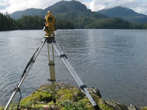
Modern Bathymetric Survey Systems for Saudi Arabia and Qatar
Compass Arabia uses state-of-the-art technology and international standards to conduct our Bathymetric Survey for Saudi Arabia and Qatar. We employ:
Both single- and combination sonar devices for mapping at high precision underwater.
For precise location and depth measurement, use GNSS and RTK GPS.
Software for handling data that creates precise digital terrain models (DTMs) from raw data.
Large-scale marine and coastal projects require accurate, dependable, and comprehensive underwater maps, which these tools enable us to provide.
The advantages of performing bathymetric surveys in Saudi Arabia and Qatar
- Improved scheduling of projects. Producers and engineers may plan marine projects with a thorough understanding of underwater conditions thanks to bathymetric info.
- Guidance and Protection Safer shipping and port operations are ensured by accurate seabed maps, which lower risks for companies.
- Preservation of the Environmental Bathymetric surveys aid in the monitoring and preservation of delicate marine habitats by examining seafloor properties.
- Economical Remedies Time and money are saved during production when mistakes and modifications are reduced by efficient underwater mapping. These advantages equate into increased safety, sustainability, and efficiency across all marine activities for developing coastal economies like Saudi Arabia and Qatar.
The Role of Compass Arabia in Bathymetric Survey Excellence
Compass Arabia is a reputable company that provides unparalleled precision and competency in bathymetric surveys for Saudi Arabia and Qatar. Our skilled surveyors and engineers guarantee that every survey satisfies the highest international standards thanks to their years of expertise on maritime and coastline projects.
Our bathymetric surveys give clients the assurance and clarity they need to proceed precisely, whether it’s for overseas development, harbour extension, or sustainability evaluation.
Conclusion
Bathymetric surveys for Saudi Arabia and Qatar are essential to safe, sustainable, and effective marine growth within today’s rapidly expanding coastal economies. Compass Arabia remains a leader in underwater mapping solutions by fusing creativity, experience, and technology.
Our objective is straightforward: to provide precise, trustworthy, and useful data that aids in the development of Saudi Arabia’s and Qatar’s shipping infrastructure for years to come.