Introduction
In the currently quickly evolving building and infrastructure industries, accuracy and productivity are more important than ever. Despite their dependability, traditional survey methods can be labour-intensive and time-consuming. Drone surveys in Saudi Arabia and Qatar are having a big influence here. For projects of all kinds, Compass offers cutting-edge drone survey services that are intended to produce quick, precise, and affordable results. Our use of drones guarantees that your initiatives, from checking on the environment to land improvement and construction are carried out clearly and confidently.
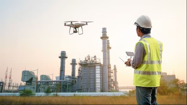
What is a Drone Survey?
Drone surveys collect extensive aerial data using unmanned aerial vehicles (UAVs) fitted with sophisticated sensors and cameras with excellent resolutions. After processing, this data is converted into precise maps, digital terrain visuals, and models in 3D. Drones can swiftly cover vast regions and offer insights that are not achievable with ground-level surveys, in contrast to standard surveying techniques.
Benefits of Drone Surveys in Saudi Arabia and Qatar
Quickness and Effectiveness
Drone surveys significantly cut down on the amount of time needed to collect data. Days or even hours can now be used to finish a process that used to take weeks. This facilitates meeting timelines without sacrificing quality for project managers in Saudi Arabia and Qatar.
Unrivalled Precision
Drone Survey in Qatar and Saudi Arabia provides precise measuring and extremely accurate mapping by combining GPS, LiDAR, and photogrammetry. For design preparation, plans for building, and tracking advancements, this degree of detail is crucial.
Economical Fixes
Total expenses are greatly reduced by drone surveys, which also reduce labour needs and project delays. Because it can detect any problems early, planners and suppliers favour it because it saves time and costs.
Improvement of Comfort
Surveyors no longer have to physically enter dangerous locations like steep slopes, congested roadways, or construction regions thanks to drone surveys. While still gathering crucial project data, this guarantees protection.
Utilising Drone Survey Services
Our drone technology at Compass is used in a variety of industries and provides flexible solutions.
Engineering Projects: Keep an eye on developments, gauge stockpiles, and guarantee site precision.
Create thorough topographic maps for planning and design purposes in land development.
Climate Studies: Monitor water management, vegetation shifts, and coastline erosion.
Urban Management: Accurate and current mapping can help smart city projects.
Roads, bridges, and drainage systems need all be precisely surveyed for infrastructure projects.
Why Pick Compass for Saudi Arabian and Qatari Drone Surveys?
We at Compass take great satisfaction in providing more than simply facts. Our experience guarantees that each project gains from:
The newest sensors and cameras are featured in cutting-edge drone technology.
Knowledgeable Team: Experts with expertise who are aware of the terrain and project needs in the area.
Customised Options: Services designed specifically for clients in the public, private, and business industries.
Demonstrated Performance History: Completed drone survey missions in Saudi Arabia and Qatar.
Our dedication to precision, security, and customer satisfaction distinguishes us as a reliable partner in the area.
Surveying’s Prospects in the GCC
Drone surveys will become more and more important as the GCC expands with large-scale infrastructure and urban development projects in Saudi Arabia and Qatar. Due to its dependability and effectiveness, drone technology is being used by both the public and private sectors. Through the integration of originality and accuracy, Compass is contributing to the development of a more intelligent, secure, and sustainable future for the area.
Conclusion
Drone technology has changed the way surveys are conducted and is now the answer instead of the problem. Our Drone Survey in Qatar and Saudi Arabia services at Compass enable customers to make better plans, construct more quickly, and use resources more effectively. Our drone surveys give your project the precision and assurance it requires, whether it’s for sustainability inspection, land growth or building.